GIS group says states progressing on data, yet gaps remain

A report published last month by National States Geographic Information Council showed that states are making strides in developing their geospatial data capabilities, but that much work remains if they’re ever going to complete a national mechanism for sharing common sets of mapping data, which is used in everything from package delivery to emergency response services.
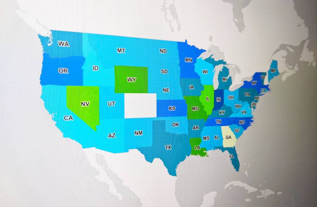
The 2021 edition of NSGIC’s Geospatial Maturity Assessment is the second time the organization included letter grades evaluating each state’s GIS efforts. Most states received an A or B, some received a C and Georgia received the lowest grade: D+. But overall, states are making progress, with grades in each category — such as transportation, address and elevation data — either remaining steady or improving.
Perhaps even more promising was that participation in the assessment rose from 41 states in 2019 to 48 in 2021. For years, GIS officials at all levels of government have wanted to create a National Spatial Data Infrastructure, allowing agencies at all levels of government — as well as private sector organizations and higher education institutions — to share geospatial data. Karen Rogers, Wyoming’s enterprise GIS and data visualization coordinator and a NSGIC member who developed the idea of a state report card, said this year’s assessment shows states are “on the right track” to meet that goal.
“A true National Spatial Data Infrastructure is nothing without states,” Rogers said. “Until and unless states are given better footing and inclusion and involvement in NSDI development, we will never see its fruition.”
The assessment breaks down each state’s efforts to organize GIS data, a reference for states where officials want to ask other states for help. Rogers said the states that are using GIS best — a cohort that includes Indiana, Kansas, Massachusetts, Minnesota, New York, North Carolina, Oregon and Tennessee, as well as the District of Columbia — share at least two common traits: they employ geospatial information officers and practice “effective” GIS governance.
“Governance is needed to really be effective because it defines the swim lanes, it builds confidence and builds trust in the ability to work together,” Rogers said. ”It’s only through that effective governance that you know the common rules of the road.”
Before a national infrastructure can be developed, states must organize their efforts at the state level. Recent efforts to integrate GIS data in elections processes and the development of a modern, IP-based 911 system illustrate why GIS isn’t an unimportant, arcane art, but a practical tool used by nearly everyone.
The recent report includes sections on next-generation 911 and elections, revealing growing maturity among states’ efforts to use GIS data for both. Nearly half of states that responded to the assessment said they maintain an accurate, current statewide voting precinct data layer. And for 911, a growing number of states have established processes to aggregate and normalize GIS data, while 24 states reported interstate coordination of GIS data for next-generation 911, up from 13 states in 2019.
Rogers said developing the NSDI is important because it’s used for package delivery, public safety, equity analysis, public health and other areas of policymaking.
“If you’re using a data set that’s out of date, that’s inaccurate, then you’re getting bad results and you’re making bad decisions, and it just has a snowball effect to impacts and consequences of using bad data,” she said, noting that many states are also currently deciding how best to spend funding from the $1.2 trillion infrastructure law. “Having good authoritative spatial data that is sourced from the right level of government is critical to spending that money wisely and effectively.”


